Welcome to CityDistance.io, your new secret weapon for mastering geography games and exploring the world through distances.
If you’re a fan of SatZoom, Satle, or UnZoomed, you know the feeling: you’ve made a guess, and the game tells you, “The target city is 1,234 km away.” That’s a great hint, but where exactly is that? A single distance creates a huge circle of possibilities. Two distances? That’s where the magic happens.
🎯 Why We Built This Tool
Geography games have taken the world by storm. Every day, millions of players try to guess a mystery country or city. But most map tools are designed for getting directions, not for triangulation.
We realized that while you can easily find the distance between City A and City B on traditional map apps, it’s surprisingly hard to answer the reverse question:
“Which city is 500km from Paris and 800km from Berlin?”
That’s why we built CityDistance.io. It is the first tool specifically optimized for this kind of “reverse” geographic search.
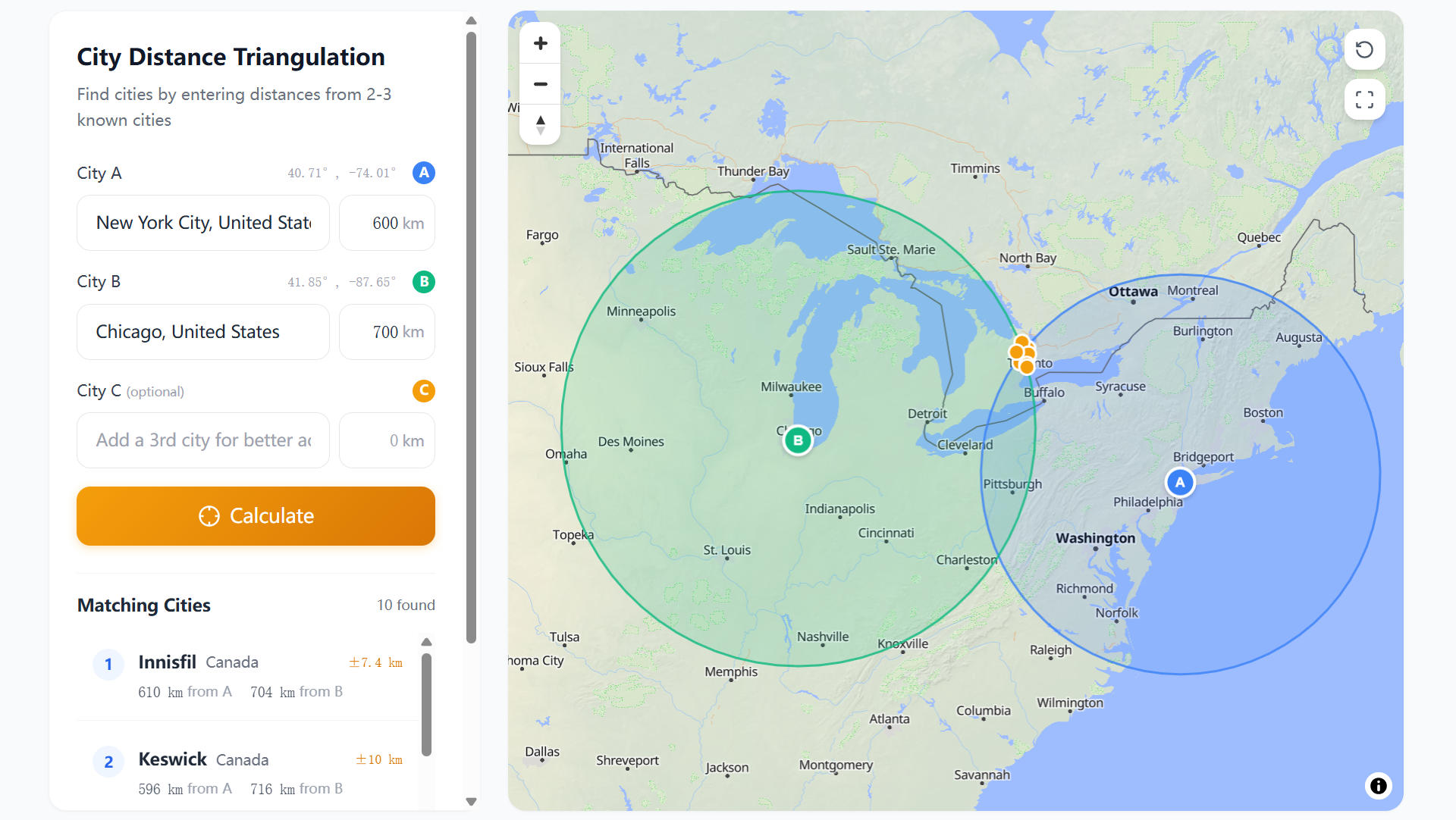
⚙️ How It Works
Our tool uses the Haversine formula to calculate great-circle distances on the Earth’s spherical surface. But we didn’t stop at simple calculations. We built a visual Triangulation Engine.
📍 Step 1: Select Your Reference Cities
Start with cities you know. Maybe it’s your previous guesses in a game, or just major landmarks.
📏 Step 2: Enter Distances
Input the distance hints you’ve received. Our tool accepts:
- 🏁 Kilometers (km) - The standard for most games.
- 🛣️ Miles (mi) - For our US users.
- ⚓ Nautical Miles (nm) - For aviation and maritime enthusiasts.
🚀 Step 3: Triangulate!
Hit calculate, and watch as we draw the distance rings on the interactive map. The intersection points reveal your mystery location. We even list the most likely cities in that area sorted by population!
🌍 Perfect for SatZoom Players
If you play SatZoom, you get a distance and direction hint after every guess.
- Guess a country (e.g., France 🇫🇷).
- SatZoom says:
3,200 km ↗️. - Enter “Paris” (capital of France) and “3200” into CityDistance.io.
- Guess another country (e.g., Egypt 🇪🇬).
- SatZoom says:
1,500 km ↖️. - Enter “Cairo” and “1500”.
- The intersection point shown on our map is your answer! 🎉
🔮 What’s Next?
This is just the beginning v1.0 release. We have an exciting roadmap ahead, including:
- ⭕ “Radius Search”: Find all cities within X km of a point.
- 🧩 Daily Challenges: Test your triangulation skills with our own puzzles.
- 📚 More Data: Expanding our database beyond the current 33,000 cities.
Give it a try now using the calculator above, and let us know what you think!
Happy mapping! 🗺️